- Home
- Bangkok Museums
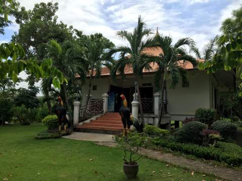
- Nong Chok Museum
Nong Chok
Museum
the Muslim legacy
By Eric Lim
The Nong Chok Museum preserves the history and way of life of old communities living in a district in Bangkok that still has a very pleasant rural atmosphere, it doesn’t feel like Bangkok at all.
It is one of the 26 community museums set up by the Bangkok Metropolitan Authority to preserve the history, customs and lives of old communities in some districts in the city.
The museum is located in the Royal Park for Trees from 76 Provinces, a park where trees representing each of the provinces in Thailand are planted. (There are 77 provinces today).
Nong Chok Museum
Let’s take a virtual tour of Nong Chok, past and present.
Contents
History of Nong Chok
Nong Chok, with a land area of 236 sq km, is the largest of the 50 districts in Metropolitan Bangkok. It’s about 15% of the land area of Bangkok but has about 1% of the population.
The district got its name from the water lettuce growing in the canals and streams in the area (nong – swamp, chok – water lettuce) and is located at the eastern extremity of the city with Chachoengsao province to the east.
Please see map of Nong Chok district.
Click to view a larger map
The history and development of Nong Chok is linked to the digging of the Saen Saab Canal that cuts across the district from west to east and the migration of Muslims from the seven provinces in southern Thailand. (See following section)
Nong Chok was initially a district in Minburi which was then a separate province. During the Great Depression in 1931, Minburi ran into financial problems and was transferred to the administration of Bangkok city.
Nong Chok then became a district in neighbouring Chachoengsao province to the east. During the reorganisation of provinces and districts around Bangkok in 1972, Nong Chok, became a district in Bangkok city together with Thonburi and Phra Khanong.
In 1985, the Bangkok Metropolitan Administration Act was passed and Nong Chok became one of the 50 districts in the Bangkok Metropolitan Authority (BMA).
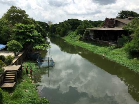
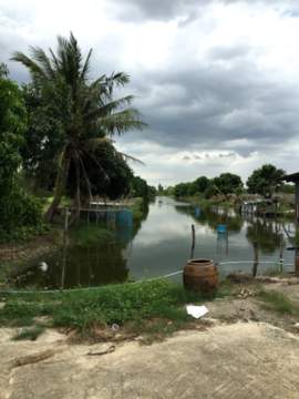
Saen Saab Canal in Nong Chok
In the reign of King Rama III (1824 – 1851), Siam as it was called then, got into a long and disastrous war with Vietnam for control over the Cambodian court in Phnom Penh.
The war which started in 1833, dragged on intermittently until 1845/46 when a settlement was reached and in 1848, a king supported by Siam was crowned in Phnom Penh.
A consequence of this long war was the digging of a canal linking the centre of Bangkok to the Bang Pakong River in Chachoengsao to serve as a means of troop movement and supply. Roads in those days were non-existent and it was easier to travel on water.
Thousands of Chinese labourers were conscripted to dig this canal which was more than 70 km running across the city in an east-west direction.
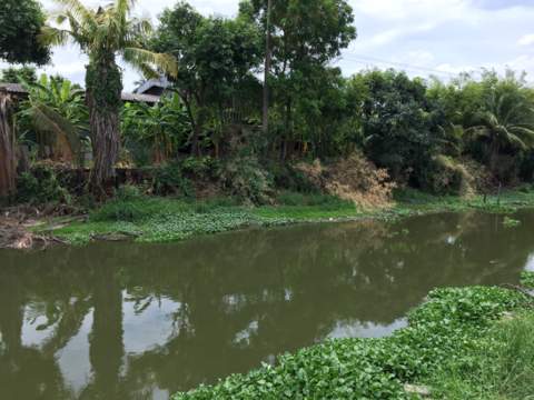
After the war, there was a mass migration of Muslims from the seven provinces of the Patani Kingdom in the south to settle in the uninhabited areas along the Saen Saab Canal in Nong Chok. Their descendants live in the area to this day.
Saen Saab near the Aulhusna Mosque
These migrations were not voluntary and usually took place after a war and conquest. The Patani Kingdom’s relationship with Siam was alternating between independence, direct rule or as a tributary since the Ayutthaya era with frequent wars with Siam.
The tribute paid by Patani to Siam was called bunga emas or golden flowers.
In the reign of King Rama I (1782 – 1809), Siamese rule was re-imposed on Patani. After a couple of rebellions in the late 1700s and early 1800s, the kingdom was divided into seven muang or provinces (Patani, Nongchik, Ra-ngae, Rahman, Saiburi, Yala and Yaring) to weaken it.
In 1831 there was another rebellion in Patani which was suppressed in 1832. This could have prompted the forced migration after the Siamese-Vietnamese war in 1846.
There’s an interesting story in the Nong Chok Museum on how the canal got its name. As the canal was dug by Chinese labourers, it was initially called Khlong Jek (khlong – canal, jek – a derogatory term used for the Chinese in the early days).
The name didn’t stick though, thanks to the humble mosquito which infested the area. The residents were sorely bitten, (saab – sore) by the numerous mosquitos (saen – 100,000) and that’s how the canal got to be called Khlong Saen Saab!
Religious harmony in Nong Chok
The situation in Nong Chok today is a far cry from those early days. The first image that catches a visitor’s eye on entering the Nong Chok Museum aptly sums up the character of the community here; it’s a picture of a mosque, a temple and statue of the Virgin Mary among golden ears of rice.
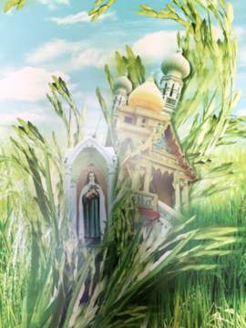
Religious harmony
The population of Nong Chok consists of about 85% Muslims, the others being Buddhists, Christians and a big Mon community living in an area that’s still largely rice fields.
The Mon were originally from Pegu in Burma. Owing to Burmese persecution they migrated to Siam and many fought in the Siamese army during the Burmese-Siamese wars. For more on the Mon please see Lat Krabang Museum.
Places of worship in Nong Chok
There are 43 mosques in Nong Chok, 16 temples and one Catholic church. Here’s a sample of some of these places of worship in this district.
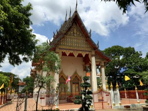
Aulhusna Mosque
This is the biggest and most important mosque in Thailand. The Office of Islamic Council of Thailand is located in the vicinity and so is the residence of the Chula Ratchamontri, the spiritual leader of the Muslims in Thailand.
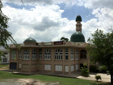
Aulhusna Mosque
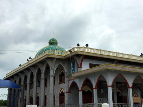
Darulmuttakeen Mosque
Located on the banks of the Saen Saab, the Darulmuttakeen Mosque is more than 100 years old. It was originally a wooden building and Muslim residents donated funds to construct a brick building which was completed in 1893.
The mosque is also a centre for religious studies.
Darulmuttakeen Mosque
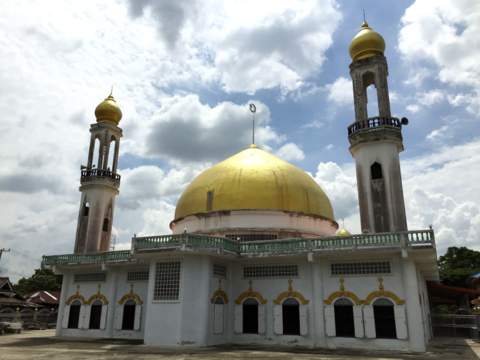
Darus Salam Mosque
Darus Salam Mosque
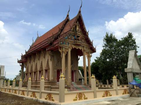
Wat Nong Chok
Wat Nong Chok is the main temple for the Buddhists in Nong Chok. A group of residents donated land totaling 500 rai (80 hectares or about 200 acres) and funds to build this temple in 1868. The temple became a centre for Buddhist teaching in 1920.
There are two schools in the temple grounds, a primary and a secondary school, named after Phraya Pak Di Noraset who built these schools in 1918.
Wat Nong Chok
Wat Mai Charoenrat
This is an important temple for the Mon community living along the Khlong Sibsi (Canal 14) home to the biggest Mon community in Bangkok. The canal is the border between Nong Chok and Chachoengsao.
The Mon community celebrates Songkran here every April by merit making, with colourful processions and dances.
Wat Mai Charoenrat
St Theresa Church
This Catholic church is the only church in Nong Chok. There’s a school named after the church and also a cemetery across the road from the church.
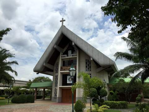
St Theresa Church
Please see this map for the location of these places of worships in Nong Chok.
Click here to view a larger map
The way of life
The area in Nong Chok is largely agricultural with rice being the main form of cultivation. The extensive rice fields are watered by numerous canals that also provide a source of fish.
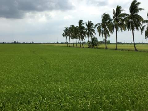
Rice fields north of the Saen Saab
The water buffalo, the traditional beast of burden, can still be seen in the fields today.
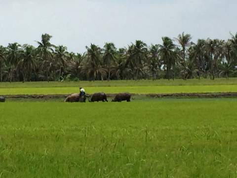
Farmer and his trusty water buffalos
Here are some of the traditional agricultural and fishing tools of the trade on display in the Nong Chok Museum.
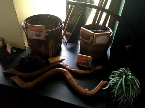
Traditional farming tools
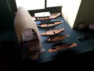
Model fishing boats
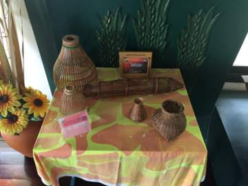
Model fishing traps
When was the last time you have seen a hand-made cradle like this?
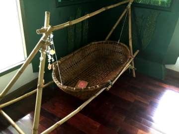
Rock-a-bye baby
Cock fighting used to be a popular sport and Nong Chok is reputed for breeding fighting cocks.
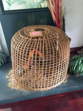
Fighting cocks in a coop
A popular form of transport in Nong Chok is the motor-cycle and side-car called "sa leng", an adaptation of the Chinese words for "three wheels".
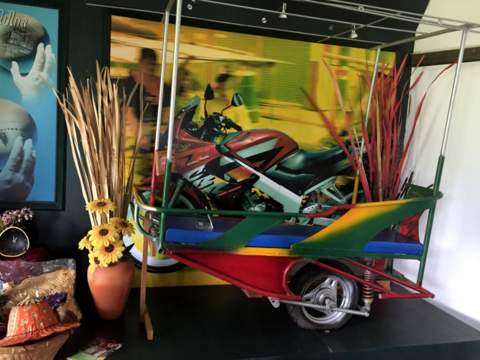
"Sa leng" on display in the Nong Chok Museum
It’s still in use. If you take a motor cycle taxi in Nong Chok today, it won’t be the two-wheeler you find in the city centre.
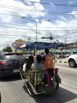
"Sa leng" in Nong Chok today
Handicraft in Nong Chok
The handicraft displays in the Nong Chok Museum feature some very attractive works of art like this carved model sailing ship, shampoos, beauty creams made from local herbs, hand-made handbags and bird cages.
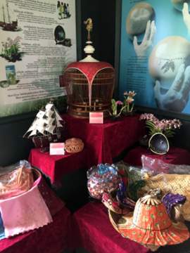
Nong Chok handicraft corner
However this piece of art takes the first prize. It looks like folding fan when it’s first unfolded; continue unfolding and you’ll get a hat! It’s very handy to have around on a hot day.
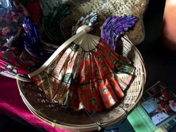
Folded out as a fan
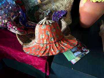
Converted to a hat
Unfortunately these outstanding products are not sold in a central shop under the OTOP scheme. They are made and sold at home which makes it a little difficult for visitors to purchase.
OTOP (One Tambon One Product) is a scheme started in 2001 to promote indigenous products like handicraft and food to be sold to augment the incomes of the local communities. Some places have special OTOP shops selling these products.
This scheme takes after the Japanese One Village One Product scheme started by Dr Morihiko Hiramatsu, Governor of Oita Prefecture, Japan.
Nong Chok today
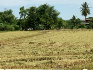
It took a second visit to Nong Chok to get a real feel of the area. The rice fields of Nong Chok are still there today with farmers drawing water from the canals for their fields. The Saen Saab is lined with rice fields for as far as the eye can see.
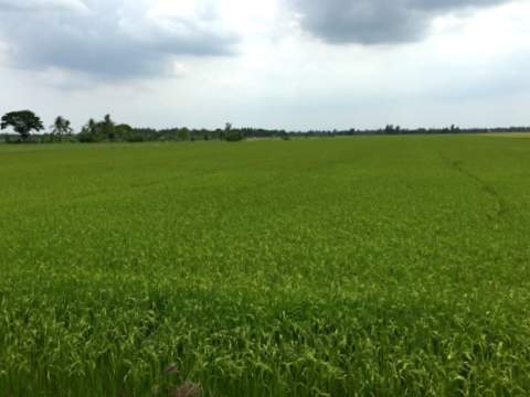
Rice fields along Soi Yang Phattana leading to Wat Mai Chareonrat
Take a look at the satellite version of the map of Nong Chok to appreciate the full extent of rice cultivation in the district presently. The terrain version shows the drainage in the area that’s crisscrossed with numerous canals and streams so vital to rice cultivation.
Not surprisingly, many of the names of places in Nong Chok are prefixed by khlong or lam (canal, irrigation ditch or waterway).
Canal in Nong Chok near Lam Pakchi
Nong Chok from what we can see is blessed with multiple crops of rice a year even though we are in the midst of a bad drought this year. This is probably because the fields are well irrigated with water drawn from the canals nearby.
There were rice fields that were recently harvested, some flooded and freshly sown, some budding green fields and others with the golden ears of rice ready to be harvested. We were lucky to catch the harvest by these mechanical harvesters in progress.
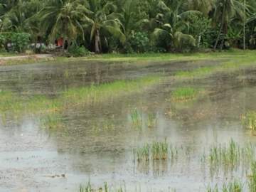
Freshly sown flooded rice field
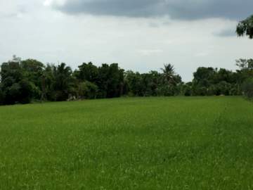
Lush green field
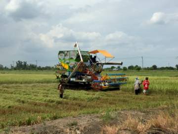
Mechanical harvester at work
Job done
The area is still predominantly agricultural with the rare luxury housing estate and golf course, there are hardly any high-rise buildings. The population is strung out along the Saen Saab Canal with the major concentration around the main junction near the Nong Chok Market.
Saen Saab Canal is one the surviving canals in Bangkok and its unpolluted compared to the stretch of the canal in the city centre.
Saen Saab Canal near Nong Chok market
It was in the last place we visited that afternoon, Wat Mai Charoenrat, that we finally spotted the plant that gave the district its name. The pond just by the temple gates was filled with "chok" we could hardly see the water.
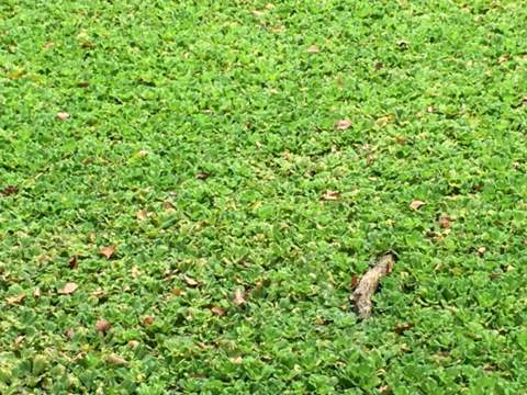
"Chok" or water lettuce in a pond – caution chok is not edible
With that we end our tour of Nong Chok district and the Nong Chok Museum. Thank you for joining us on this tour.
Our thanks
We are grateful to Khun Manirat Ruensuk, the volunteer museum administrator who was most helpful during our tour of the Nong Chok Museum. Her interesting stories made the museum visit so much more enjoyable.
A big thank you to Khun Manirat
Map to Nong Chok Museum
View in a larger map to the Nong Chok Museum
Contact details
Nong Chok Museum
Royal Park of Trees from 76 Provinces
Chalong Krung Road
Lam Pakchi sub-district
Nong Chok district
Bangkok 10530
Tel: 02 453 1099, 08 0292 9454
How to get to the Nong Chok Museum
By Car
Take the Bangkok-Chonburi Motorway 7 that goes to Suvarnabhumi Airport. Turn left to Rom Klao Road (highway 3199) then turn right to Chao Khun Thahan Road.
Continue along Chao Khun Thahan Road and turn left to Chalong Krung Road. Continue along Chalong Krung Road till you see the FBT Sportswear Factory on the opposite side. Make a U-turn, go past the factory, keep left and take the slip road next to the flyover.
The locals call the location of the museum Lam Makham.
By Airport Rail Link/taxi
Take the Airport Rail Link to the Lat Krabang Station which is one station before Suvarnabhumi Airport. From there take a taxi to the Nong Chok Museum.
Tell the taxi driver you want to go to Lam Makham in Chalong Krung Road. Lam Makham is the name of the canal where the museum is located on a slip road and U-turn under the flyover.
Getting there can be a bit tricky as there are no prominent signboards. You will see the only signboard just before the slip road.
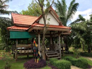
Sala at the entrance to the museum
Opening times
The Nong Chok Museum is open every day except Mondays and Tuesdays from 0830 – 1630 hours
Admission is free
For more Bangkok Museums.
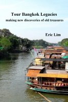
Tour Bangkok Legacies – my first e-book
If you are an independent traveller, here's a handy e-guide book, Tour Bangkok Legacies, that will help you along as you explore the streets of Bangkok and discover its old treasures. It's complete with historical descriptions, maps and detailed directions on how to get to these places.
My Kindle e-book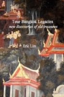

What's New
-
Prayer for Funding of my Business Venture
Jul 19, 23 04:17 AM
-
Hi from London England.
Oct 15, 22 04:53 AM

Search Tour Bangkok Legacies with DuckDuckGo